

名古屋市防災アプリ app for iPhone and iPad
Developer: CAD CENTER CORPORATION
First release : 24 Mar 2014
App size: 235.59 Mb
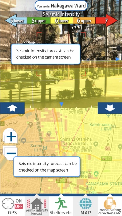
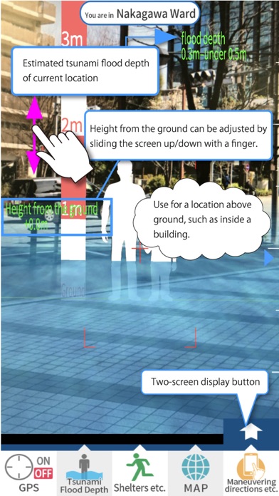
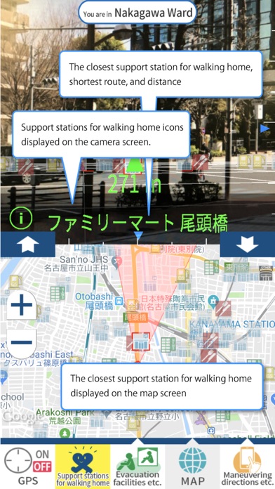
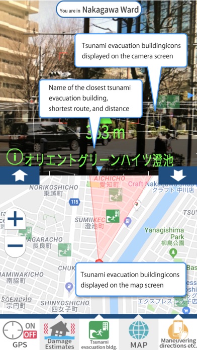
The City of Nagoya Disaster Preparedness App displays the following information for Nagoya City in Aichi Prefecture: seismic intensity forecasts and estimated earthquake damage such as liquefaction risk, tsunami flood depth, and tsunami arrival time; forecasted flood damage such as flood inundation depth and inland water inundation depth; flood control info such as observed rainfall, observed water levels, river monitor camera images, and drainage pump operation conditions; and shelter info for designated evacuation shelters, temporary evacuation spots, and tsunami evacuation buildings.
This app links to GPS data and combines actual images taken by camera with disaster preparedness info for that location for display.
■Using the Services
The City of Nagoya Disaster Preparedness App (“App”) displays earthquake, tsunami, and flood hazards predicted for the area as well as information on maps for locations such as designated evacuation shelters and tsunami evacuation buildings.
Designated evacuation shelter and tsunami evacuation building locations will display when using as for everyday disaster preparation and during actual disasters. However, please note that maps may not display due to network conditions and that tsunami inundation range displays are no more than estimates. Confirm actual damage conditions and evacuate based on government evacuation information and your own judgment.
Due to App specifications, some posted disaster preparedness information may not be up to date. Refer to disaster preparedness info released by the government as needed.
The App will collect the user’s location information on this device to display current location. This will occur only if the GPS automated tracking function is turned on for the App.
■Usage Environment
It is the user’s sole responsibility to maintain all hardware/software that is required to use the App.
There is no charge for using the App, but network charges (data communication fees etc.) are to be covered by the user.
Due to App specifications, 2D maps may not display according to the user’s network environment and network conditions.
Inquiries regarding the City of Nagoya Disaster Preparedness App
[email protected]
Disaster Prevention and Risk Management Bureau